Dry Creek RM 1.8-3.8
Yakama Nation Fisheries has developed a restoration design for Dry Creek River Mile 1.8-3.8. This design, informed by a Geomorphic Assessment and Seepage Study, will guide instream and riparian wood enrichment, constructed margin jams, and removal of a spoil pile within the floodplain. These efforts aim to encourage natural wood accumulation, bank erosion for wood recruitment, and activation of floodplains, side channels, and alcove habitat to improve conditions for steelhead lifecycles.
Dry Creek Confluence Project
Yakama Nation Fisheries is managing the Dry Creek Confluence Project, located where it joins Wind River, which aims to improve habitat for threatened steelhead populations. This project is part of a larger effort to address key issues affecting aquatic species in the Wind River Watershed, specifically to restore habitat area of high priority for steelhead recovery. Adding large woody debris to creates in-stream structures that are vital for healthy salmon and steelhead populations. The Wind River is managed as a wild steelhead gene bank, making it a high-priority area for recovery.
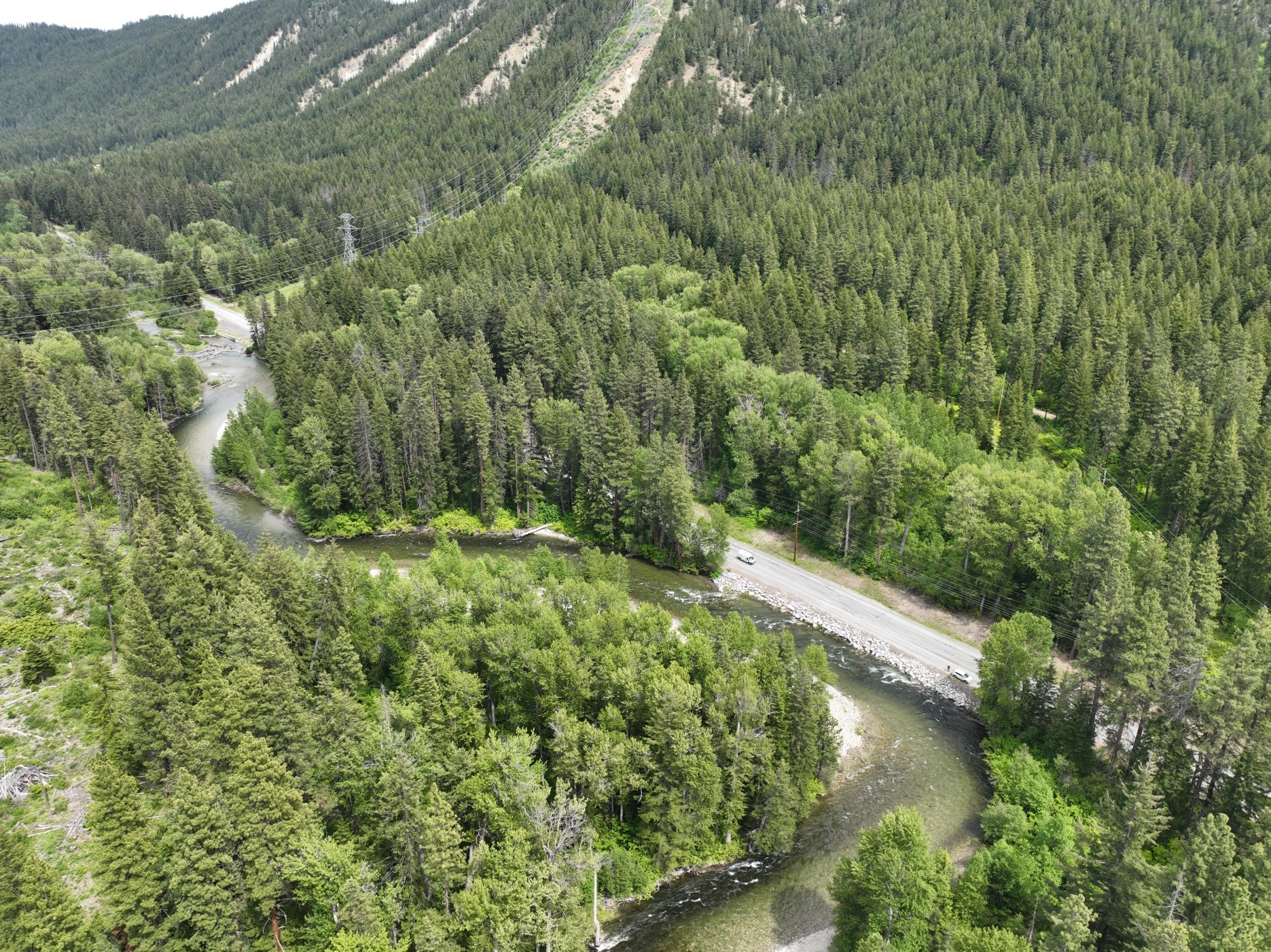
Yakama Nation Fisheries State Route 207 Project - Chelan County
Welcome to the Yakama Nation Fisheries (YNF) State Route 207 Project Summary Webpage.

Peshastin Creek Reach Assessment
Peshastin Reach Assessment identifies several potential projects in Peshastin Creek.
Nason Creek Inner Zone Project Identification
A Reach Assessment (RA) of the Lower White Pine Reach (LWP) of Nason Creek, Chelan County, WA was completed in 2009 by the USBR. The RA examines the condition of fluvial geomorphic processes and the effect on salmonid habitat, and identifies priority restoration strategies and areas. The effort presented in this document builds on the work completed in the RA by identifying more specific project opportunities within portions of the reach.
Pacific Lamprey Project
The Yakama Nation is working to restore natural production of Pacific lamprey to a level that will provide robust species abundance, significant ecological contributions and meaningful harvest within the Yakama Nations Ceded Lands and in the Usual and Accustomed areas.
Toppenish Ridge Stockwell & Pipeline
This project was implemented to assist in managing the migration of cattle from low elevations in the spring to higher elevations in the early summer. Prior to the project, upon cattle turnout on May 1, cattle would quickly travel approximately 25 miles to the headwater meadows of Satus and Toppenish Creeks. Livestock immediately impacted several important high elevation meadows, by overgrazing and by creating hardened cattle trails. These impacts further increased channel incision and bank erosion in these areas..
Satus Creek Irrigation Dam Removal
Satus Dam—also known as the Shadduck Dam—was installed in Satus Creek over a half-century ago by Wapato Irrigation Project (WIP). The dam was used to divert water to supplement the irrigation water in the Satus District of WIP. The diversion had been obsolete for over 20 years and WIP intended to remove the dam, but lacked funding.
Lincoln Meadows Restoration
Lincoln Meadows is a headwaters meadow for Toppenish Creek. Headwater meadows are important because they contain culturally important first foods and function as water storage to maintain summer base flows in streams, which supports aquatic life. Lincoln Meadows has been impacted by a variety of human related activities, such as roads and cattle grazing, that have severely degraded the meadow's capabilities.
Panther Creek Passage Barrier Removal
On August 6, 2011, Yakama Nation Fisheries, Yakama Reservation Watersheds Project (YRWP) completed the implementation of a restoration action at two road/stream interfaces on Panther Creek to improve stream function and facilitate fish movement. Sites within the Panther Creek watershed have been degraded due to various human activities (e.g., grazing, road building, and logging). These problems are most obvious at the site on Panther Creek where Fort Simcoe Road # 80 transects T10N, R13E Section 13 and further downstream in T10N, R13E Section 26.