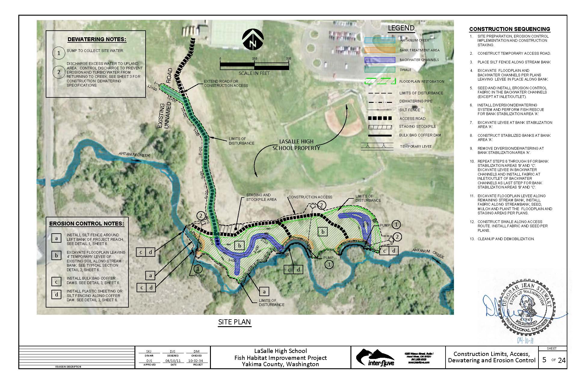
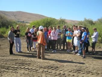
Yakama Reservation Watersheds Project staff completed a bank stabilization and floodplain restoration project in and adjacent to Ahtanum Creek. Anthropogenic and natural factors have led to the rapid erosion of three stream meanders, a discontinuity between the floodplain and the stream, and a domination of non-native invasive vegetation within the project site. Endangered Species Act listed species: Mid-Columbia River steelhead trout and bull trout, Chinook, and coho; utilize Ahtanum Creek for multiple life history stages. The project site is located on LaSalle High School property, which offers a unique educational outreach opportunity. This initiated a cooperative effort between Yakama Nation Fisheries, LaSalle High School, and North Yakima Conservation District to restore the site by creating fish and wildlife habitat, stabilizing the three eroding banks, creating two backwater channels and a swale, and re-planting the site with native plant species pursuant to project objectives.
Stabilize three rapidly eroding meander bends on Ahtanum Creek, reconnect Ahtanum Creek with its historic floodplain, create backwater rearing areas for listed fish species within the floodplain, and re-establish native riparian and floodplain vegetation at the site.
We installed bank stabilization features at each of the three eroding meander bends. The bank stabilization features consist of a large woody debris toe with a fabric encapsulated soil lift above. All woody materials installed were composed of red fir, which was harvested in 2011. We excavated scour pools beneath the bank stabilization features to a depth of approximately three feet below existing grade to provide refuge fish habitat beneath the root wad component of the woody debris toes. We planted approximately 100 coyote willow cuttings atop each of the root wad logs prior to replacing fill material.
We removed approximately 8,500 cubic yards of soil from the floodplain adjacent to Ahtanum Creek on the north bank to maximize water storage during elevated water events. We created two backwater channels in the new floodplain, and we excavated a swale from the upstream end of the property to convey overland flow to one of the backwater channels. We revegetatd the new floodplain and swale with an upland grass seed mix and the new floodplain was also planted with shrubs and upland/riparian trees. We then placed straw mulch over the disturbed soil to retain moisture, reduce erosion, and suppress weed growth. We installed biodegradable woven coir erosion control fabric along the banks of backwater channels and within the backwater channels (in areas vulnerable to erosion). We also revegetated the backwater channels with native wetland plant seed. We installed large wood along the backwater channel margins, on the new floodplain surface, and within the backwater channels to provide further erosion protection and fish and wildlife habitat. To improve access for student educational activities, two bridges were constructed by YRWP employees over the two backwater channels.
Instream work areas were isolated and dewatered using bulk bag coffer dams and a dewatering pump. A Yakama Nation fisheries biologist was on sight during all in-stream work periods. Fish rescue efforts followed National Marine Fisheries Society prescribed protocols. We captured several Chinook smolts and one steelhead smolt using seining and where necessary (e.g., undercut banks, streambed composition) we used electroshocking techniques to rescue fish. With each technique, three passes were completed after the last salmonid was captured. Fin clip samples were removed from salmonid species for genetic analysis. Various other species were captured including chiselmouth, pike minnow, sculpin spp., sucker, dace, shiner, ammocoete, and crayfish.
The three eroding banks on Ahtanum Creek have been armored to prevent further erosion. Critical refugia fish habitat was created by the bank stabilization features. During construction, a groundwater lens was discovered within the constructed backwater channels, which will maintain optimal rearing temperatures within these habitats, and the constructed grade within the backwaters will prevent fish stranding during periods of low flow. The swale that was installed at the site will convey overland flow to the upstream backwater channel and will prevent flooding during larger flood events. By reconnecting the floodplain, the channel will have an enhanced interaction with the floodplain during elevated flows which will allow for a more stable hydrograph. The wood that was added to the floodplain habitat will aid in dispersing the hydraulic energy during elevated flows and increase infiltration rates. The extensive revegetation of native plant species and planned weed control will allow for a healthy riparian corridor to develop in subsequent years. This will cause temperatures to be more stable, provide cover for fish, and increase wood recruitment, while providing wildlife habitat. North Yakima Conservation District continues to plant native plant species at the site and periodically performs mechanical removal of invasive plant species such as reed canary grass.
Project Photos:


Project Videos:
Status: Completed
09/20/2011 to 11/01/2011Project Manager
-
Shannon Adams ,
Technical Services Coordinator
509-945-0754